Water Quality
The growth of Los Angeles had always forced the City to be concerned
with the adequacy of its supply, and consequently its attention had always been directed outward in its search. The
new emphasis on managing the water resource brought protection of water quality to the forefront as the primary goal of good
management.
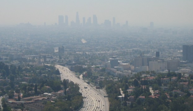
Today, Los Angeles is the second largest city in the nation.
In December 1995, Los Angeles joined the "Partnership For Safe Water Program" in an agreement with the U.S. Environmental
Protection Agency to self-assess and potentially implement additional drinking water safeguards and treatments. Los Angeles
met Partnership eligibility requirements because of its good standing under current regulations and a commitment to undertake
various phases of the program.
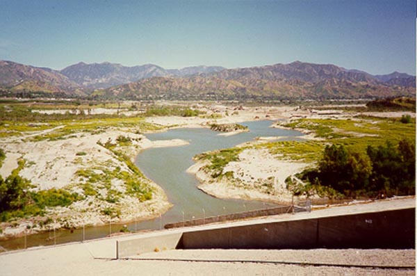
There are three sources for Los Angeles’ water: approximately
60% comes from the Eastern Sierra via the Los Angeles Aqueduct system, 15% from the San Fernando groundwater basin, and 25%
from the Metropolitan Water District’s Colorado and Feather River supplies.
Water from the Owens River watershed is protected from industrial
and agricultural contamination by DWP land management practices. However, some turbidity arises as water from the watersheds
travels through unlined channels in a natural rural setting before being diverted into the two aqueducts for its journey to
the City.
The DWP determined that a filtration plant would be necessary to
reduce this turbidity and in 1986 Los Angeles completed its first filtration plant. Using ozone and rapid rate deep
bed filters, the $146 million Los Angeles Filtration Plant treats up to 600 million gallons of water each day. It is
the largest direct filtration plant in the U.S. and the second largest ozone plant in the world.
One benefit resulting from the use of ozonation as a disinfectant
process is the reduction in formation of trihalomethanes (THMs). These chemical compounds are formed when chlorine combines
with naturally occurring organic material in the water. By using ozone as a disinfectant in the initial treatment process
instead of chlorine, the City is able to reduce THMs by as much as 50%. New operations, commencing in 1999, have allowed
the plant to convert to biologically active filtration, or biofiltration. Ozone plays an important role in growing harmless
bacteria on the filters to remove a wider range of disinfection byproducts now being regulated.
In August of 1999, Los Angeles began to fluoridate its water at the
Los Angeles Aqueduct Filtration Plant. Natural background levels of fluoride are boosted to optimal levels that help
prevent tooth decay. Additional fluoridation facilities have already, or will soon, come on line at groundwater treatment
sites and at MWD service connections.
The next 25% of the City’s water comes from MWD. As Arizona
begins to exercise its increased rights on the Colorado River, the MWD will need to rely more on northern California water
supplied through the State Water Project. When water from the State Water Project flows through the Sacramento-San Joaquin
Delta it picks up organic material from the riverbeds.
With increased use of water containing a greater amount of organic
material, higher levels of THMs in the MWD supply would have been likely. However, by using chloramines, a combination
of chlorine and ammonia, as a primary disinfectant, the MWD has taken steps to reduce this problem.
The San Fernando groundwater basin not only supplies 15% of Los Angeles’
domestic needs, but it also acts as a vast underground reservoir where water accumulates during years of abundant rainfall
and is stored for use in the future.
In 1980, newly available sensitive monitoring equipment detected
trace amounts of trichloroethylene (TCE) and perchloroethylene (PCE), as well as smaller amounts of other industrial chemicals
in the San Fernando groundwater supply.
The concentration of these contaminants is very small, measured in
parts per billion (a part per billion is equivalent to a few drops in a swimming pool). There is concern, however, that
a lifetime of exposure to even very low levels of these contaminants could have a negative health effect. Both the State
and federal government have, therefore, established very demanding standards for the amount of these contaminants that are
allowed in a water supply. The City’s groundwater supply meets all of these standards at all times.
Some of the contaminated wells have been abandoned. The loss of production
from the abandoned wells, has been made up by developing new well field such as Tujunga Well Field (12 new wells) which is
located up gradient of the significant contaminant plumes.
The San Fernando Groundwater Quality Management Plan was issued in
July 1983. The objective of this effort is to protect and upgrade the quality of the stored water in the Basin. Special
emphasis is placed on monitoring and removing the organic contaminants TCE and PCE found in the groundwater. The Plan
recommends systematic installation of sanitary sewers in designated areas through the San Fernando Valley in order to eliminate
existing commercial and industrial Private Sewage Disposal Systems and their discharge of wastewater to the groundwater basin.
The State-mandated Underground Storage Tank Program headed by the City of Los Angeles Fire Department focuses on the monitoring
and removal of gasoline, and their related constituents from the soils, in order to prevent contamination of the underlying
groundwater.
The North Hollywood Aeration Facility removes and treats the contaminated
groundwater in the upper zone of the aquifer and prevents the migration of the contaminants downward into the San Fernando
groundwater basin. The water from seven contaminated shallow wells is pumped to the top of the aeration tower. As the water
flows downward an upward air blower, flows counter-current through the water. Volatile gases trapped in the water then vaporize
and join the air stream. This air stream is filtered through activated carbon to be sure none of the contaminants are
released to the atmosphere.
The DWP is participating in several research projects aimed at developing
new technologies that will assist in the removal and destruction of source water contaminants. One such technology,
known as advanced oxidation, uses ozone and hydrogen peroxide to oxidize groundwater contaminants into harmless by-products
such as chloride and carbon dioxide. The Department of Water and Power continually monitors the purity and quality of
its water supply. More than 60,000 laboratory and field analyses are made yearly, 15,000 for bacteriological control
and the balance for chemical, physical, and radiological inspections. Sampling occurs at all sources; watershed, reservoirs,
distribution mains, and consumer taps. Water carrying and storage facilities are also checked.
DWP is required by State and Federal law to regularly test City water.
Monitoring of over 90 regulated chemicals and bacteriological contaminants is required at varying frequencies based on the
type of constituent and the type of source water. There are constituents found in drinking water that are not yet regulated.
Some of these “unregulated constituents” are monitored because they could be candidates for future regulations
or are of interest to our customers. The DWP has a crew of field and laboratory personnel who sample and test City water
every day of the year, including weekends and holidays. The distribution system water samples are collected from secured
water sampling taps installed throughout the city. Regular water samples are also collected from watersheds, reservoirs,
groundwater supply wells, storage facilities and other locations. There are over 170 different constituents which DWP
tests for in the water.
The people of Los Angeles today enjoy safe drinking water from high
quality sources that meets or exceeds all standards set by state and federal agencies. The Los Angeles Department of
Water and Power is constantly working to assure that this continues into the future.
The San Fernando Valley today still has some of its own water sources. Approximately
20 miles out of the valley, the San Gabriel Mountains serve as the major stream source of the Pacoima, the Little Tujunga,
and the Big Tujunga. At the opposite west end of the valley, Bell Creek flows from Simi Hills and the Santa Susana Mountain
Range. However, aside from these, the waters moving through the valley are intermittent at best, and are normally seen only
after a rare wet cycle. Land developers have covered up most small creeks with eroded mountain sediments of rock, sand, gravel,
or clay, in an effort to sell real estate property. When the wet cycle comes inevitably in the winter, uninformed and unsuspecting
homeowners have to deal with foundation cracks and flood conditions, dumfounded that five months prior they were being warned
to conserve water amidst the summer drought.
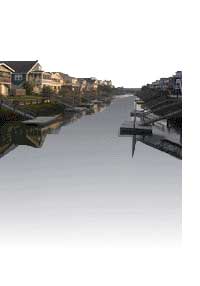
The San Fernando Valley, rectangular in shape and surrounded by ever eroding
mountains, slopes towards the southeast into “The Narrows.”This is a one mile wide opening through which the eroded
mountain materials travel in the river. However, more sediment remains in the old inland sea than is carried out to the ocean.
The resulting porous nature of the valley ground absorbs this silt and water underground, creating a reservoir that inch towards
The Narrows. The result is a slow flowing underground river that is pressurized, because only so much material can physically
pass through The Narrows at once under natural conditions. This is what is known as the source of the Los Angeles River, and
this is why the Valley was so important to the City of Los Angeles in the beginning years of the twentieth century.